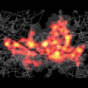
Spatial Data Science and Applications
Spatial (map) is considered as a core infrastructure of modern IT world, which is substantiated by business transactions of major IT companies such as Apple, Google, Microsoft, Amazon, Intel, and Uber, and even motor companies such as Audi, BMW, and Mercedes. Consequently, they are bound to hire more and more spatial data scientists. Based on such business trend, this course is designed to present a firm understanding of spatial data science to the learners, who would have a basic knowledge of data science and data analysis, and eventually to make their expertise differentiated from other nominal data scientists and data analysts. Additionally, this course could make learners realize the value of spatial big data and the power of open source software’s to deal with spatial data science problems.This course will start with defining spatial data science and answering why spatial is special from three different perspectives - business, technology, and data in the first week. In the second week, four disciplines related to spatial data science - GIS, DBMS, Data Analytics, and Big Data Systems, and the related open source software’s - QGIS, PostgreSQL, PostGIS, R, and Hadoop tools are introduced together. During the third, fourth, and fifth weeks, you will learn the four disciplines one by one from the principle to applications. In the final week, five real world problems and the corresponding solutions are presented with step-by-step procedures in environment of open source software’s.
None
Syllabus
Syllabus - What you will learn from this course
Week 1
Understanding Spatial Data Science
Week 2
Solution Structures of Spatial Data Science Problems
Week 3
Geographic Information System (GIS)
Week 4
Spatial DBMS and Big Data Systems
Week 5
Spatial Data Analytics
Week 6
Practical Applications of Spatial Data Science
FAQ
When will I have access to the lectures and assignments?
Access to lectures and assignments depends on your type of enrollment. If you take a course in audit mode, you will be able to see most course materials for free. To access graded assignments and to earn a Certificate, you will need to purchase the Certificate experience, during or after your audit. If you don't see the audit option:
What will I get if I purchase the Certificate?
When you purchase a Certificate you get access to all course materials, including graded assignments. Upon completing the course, your electronic Certificate will be added to your Accomplishments page - from there, you can print your Certificate or add it to your LinkedIn profile. If you only want to read and view the course content, you can audit the course for free.
Is financial aid available?
Yes. In select learning programs, you can apply for financial aid or a scholarship if you can’t afford the enrollment fee. If fin aid or scholarship is available for your learning program selection, you’ll find a link to apply on the description page.
Reviews
No hands on experience on GIS tools rather than that content was superb.
The most comprehensive introductory cause in Geo-spatial Data science . I love it.
The entire concept of Spatial Data Science is simplified to the understanding of an intermediate learner. Thank you
This is such a great course, thank you for sharing your knowledge to us about spatial data science
