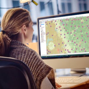
Geospatial and Environmental Analysis
Apply your GIS knowledge in this course on geospatial analysis, focusing on analysis tools, 3D data, working with rasters, projections, and environment variables. Through all four weeks of this course, we’ll work through a project together - something unique to this course - from project conception, through data retrieval, initial data management and processing, and finally to our analysis products.In this class you will learn the fundamentals of geospatial and environmental analysis during four week-long modules:
Week 1: Tour ArcToolbox and learn how to use common geospatial analysis tools built into ArcGIS
Week 2: Gain a working understanding of raster data models: symbolize, reproject, overlay, and assess rasters. Take a detour into 3D data models, and interpolation of observations into 3D surfaces and rasters
Week 3: Go in-depth on projections and coordinate systems, which are foundational to all GIS. Learn how to use environment variables to constrain your analyses and get better quality data products.
Week 4: Expand your knowledge of symbology. Learn how to visually display your data by classifying it in logical groupings and then symbolizing it on your map.
Take Geospatial and Environmental Analysis as a standalone course or as part of the Geographic Information Systems (GIS) Specialization. You should have equivalent experience to completing the first and second courses in this specialization, “Fundamentals of GIS” and “GIS Data Formats, Design, and Quality”, before taking this course. By completing this third class in the Specialization you will gain the skills needed to succeed in the full program.
Create 3-dimensional surfaces
Create triangulated irregular networks (TIN) and modify rasters to 3D data
Develop and analyze data for the geospatial analysis project
Design color ramps for your data
Syllabus
Syllabus - What you will learn from this course
Week 1
Course Overview & Geospatial Analysis
Week 2
Rasters and Surfaces
Week 3
Classifying and Viewing Data
Week 4
Working Through a Project
FAQ
When will I have access to the lectures and assignments?
Access to lectures and assignments depends on your type of enrollment. If you take a course in audit mode, you will be able to see most course materials for free. To access graded assignments and to earn a Certificate, you will need to purchase the Certificate experience, during or after your audit. If you don't see the audit option:
What will I get if I subscribe to this Specialization?
When you enroll in the course, you get access to all of the courses in the Specialization, and you earn a certificate when you complete the work. Your electronic Certificate will be added to your Accomplishments page - from there, you can print your Certificate or add it to your LinkedIn profile. If you only want to read and view the course content, you can audit the course for free.
Is financial aid available?
Yes. In select learning programs, you can apply for financial aid or a scholarship if you can’t afford the enrollment fee. If fin aid or scholarship is available for your learning program selection, you’ll find a link to apply on the description page.
What prior experience do I need to take this course?
You should have some experience in GIS before taking this course - it's not for absolute beginners. This is the third course in the Geographic Information Systems specialization, and you should have taken the first two courses in the specialization, "Fundamentals of GIS" and "GIS Data Formats, Design, and Quality", here on Coursera before enrolling in this course, or have equivalent experience. If you're not sure if you have equivalent experience, you can audit those courses for free to look through the materials and fill in any gaps. Search for them by name on the site to find them.
Since all of the courses in the specialization run monthly, you won't miss out on this course by enrolling in those courses first. This course will have a new session once you have the skills needed to take it.
Reviews
Even though I work in GIS, I rarely have the opportunity to go past very basic geoprocessing in my work. This course gave me the opportunity to expand my knowledge and experience.
I enjoyed this part most of the three courses in the GIS specialization that I have earned certificates. Thanks to Dr. Nick Santos for his interactive teaching, assignments and projects.
It was a good experience, getting familiar with the tools and all. But, the videos were short, and it did not have enough assignments to work on our own.
What I liked most about the course is the gradual progression is so great! Great deal of efforts invested for making this course so awesome. I had a great time leaning.
