Fundamentals of GIS
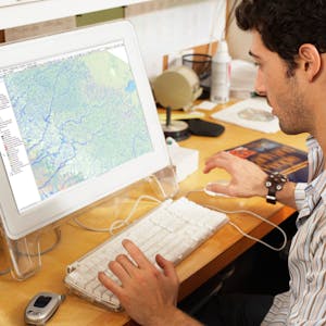
Explore the world of spatial analysis and cartography with geographic information systems (GIS). In this class you will learn the basics of the industry’s leading software tool, ArcGIS, during four week-long modules: Week 1: Learn how GIS grew from paper maps to the globally integrated electronic software packages of today. You will install ArcGIS on your computer and learn how to use online help to answer technical questions.
Week 2: Open up ArcGIS and explore data using ArcMap. Learn the foundational concepts of GIS, how to analyze data, and make your first map.
Week 3: Make your own maps! Symbolize data and create an eye-catching final product.
Week 4: Share your data and maps and learn to store and organize your data.
Take Fundamentals of GIS as a standalone course or as part of the Geographic Information Systems (GIS) Specialization. By completing the first class in the Specialization you will gain the skills needed to succeed in the full program.
Students who need an ArcGIS license will receive a non-commercial, 1 year student license for participation in this course and specialization.
Define core geospatial concepts
Practice with subset data using selections and feature attributes
Create map books using advanced mapping techniques
Create layer and map packages
Syllabus
Syllabus - What you will learn from this course
Week 1
Course Introduction and Introduction to Geographic Information Systems (GIS)
Week 2
ArcGIS Basics
Week 3
Making Maps With Common Datasets
Week 4
Retrieving and Sharing Data
FAQ
When will I have access to the lectures and assignments?
Access to lectures and assignments depends on your type of enrollment. If you take a course in audit mode, you will be able to see most course materials for free. To access graded assignments and to earn a Certificate, you will need to purchase the Certificate experience, during or after your audit. If you don't see the audit option:
The course may not offer an audit option. You can try a Free Trial instead, or apply for Financial Aid.
The course may offer 'Full Course, No Certificate' instead. This option lets you see all course materials, submit required assessments, and get a final grade. This also means that you will not be able to purchase a Certificate experience.
What will I get if I subscribe to this Specialization?
When you enroll in the course, you get access to all of the courses in the Specialization, and you earn a certificate when you complete the work. Your electronic Certificate will be added to your Accomplishments page - from there, you can print your Certificate or add it to your LinkedIn profile. If you only want to read and view the course content, you can audit the course for free.
Is financial aid available?
Yes. In select learning programs, you can apply for financial aid or a scholarship if you can’t afford the enrollment fee. If fin aid or scholarship is available for your learning program selection, you’ll find a link to apply on the description page.
How often does this course run? If I miss the current session, when can I enroll?
This course and the next course in the specialization have sessions that begin weekly, so if you miss a session or fall behind, you can enroll when you're ready. Courses each take about 4 weeks to complete, depending on the pace you follow. Later courses run slightly less frequently, from every 2 weeks to every month based on enrollment. The capstone project runs approximately every 8 weeks in order to ensure enough students are in the course to give feedback and grades. The capstone project also takes longer (recommended time is about 8 weeks).
What software is required to take this course?
This course currently uses ArcMap and requires a computer running Windows. A license for ArcGIS is provided in the course. Learners on Mac or Unix systems can still participate, but must set up Windows somewhere, such as in BootCamp, Parallels, or another virtual machine, in order to install ArcGIS.
In the near-future we will be transitioning the course to teach ArcGIS Pro and QGIS together, so you'd be able to use whicher works on your system and based on what you wish to learn.
Reviews
Absolutely incredibly well-designed course for anyone who is looking to learn the fundamentals of GIS. The knowledge and insights provided in the course are well delivered. Well-deserved 5 stars.
Well developed course, everything leads you up to a final assignment that helps test what you've learned and gives you a great general idea of some of the cool things you can do with ArcGIS.
I finished the course, I do not know why it indicates to me as if I had not finished
I would like answer, please. My email: [email protected]
Why don't answer me?
Regards
Victor Ramon
I learned a lot from this course. Kudos to the team for making the lessons easily understandable even for beginners who just started to explore the world of GIS. Highly recommended course!!!
